Oil & Gas

Inspect intelligently,
minimize downtime

Oil and Gas Solutions

Pipelines

  • Plan and construct pipelines effectively with digital terrain surveys of potential routes.
  • Monitor pipelines spread across hundreds of kilometers of difficult terrain.
  • Identify any encroachments in the right of use (RoU) corridor and take action.
  • Quickly detect anomalies like pipeline leakages, sabotage & theft.

Upstream

  • Remotely inspect and monitor flare stacks, cooling towers, and hotspots safely.
  • Conduct day and night surveillance for monitoring assets and detecting intrusions.
  • Digitize surveys & inspections with 2D maps and 3D models.
  • Automate drone flights for routine patrolling and safety inspections.

Downstream

  • Automate drone flights for site surveying and monitoring.
  • Reduce response time in case of emergency & minimize safety hazards.
  • Monitor construction projects with real-time data and increase workflow efficiency.
  • Maintain quality checks through aerial data and quickly respond to anomalies.

Our Expertise in Oil and Gas

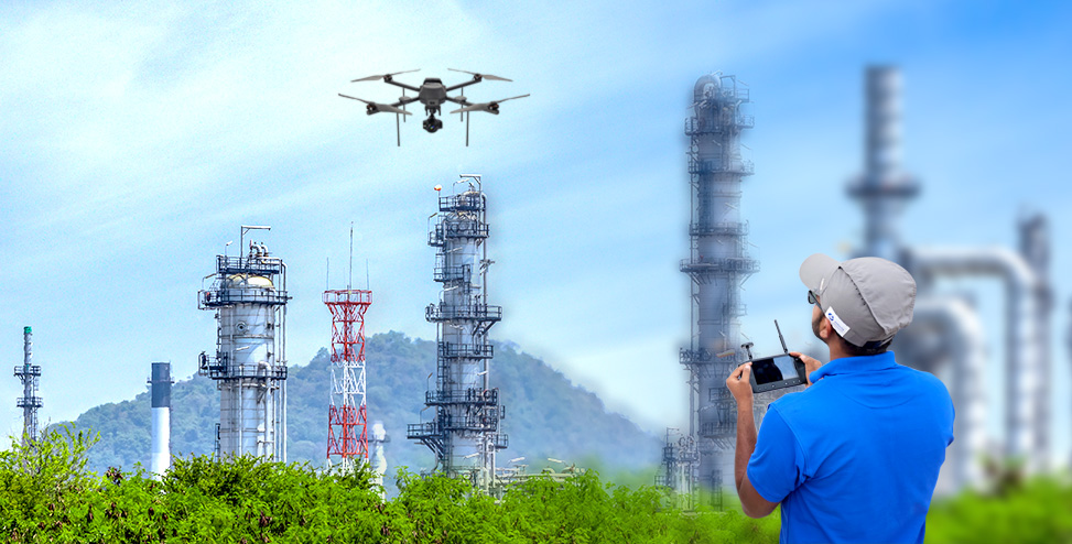
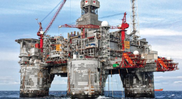
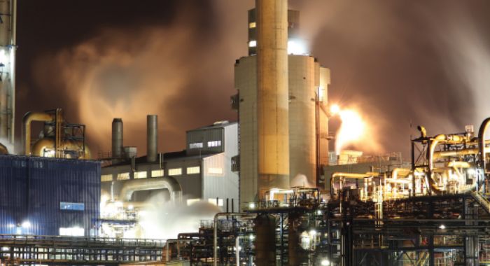
One-stop shop to provide drone solutions across the entire Oil & Gas value chain.

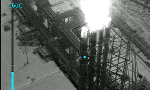
Experience in conducting safety-critical drone inspections using high-resolution RGB and thermal cameras.

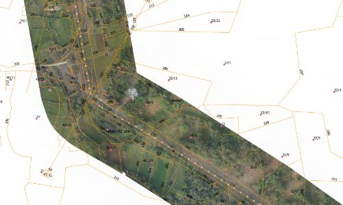
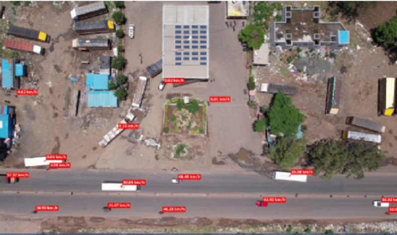
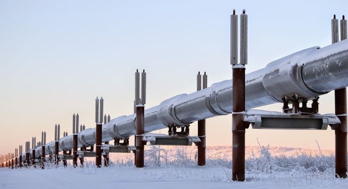
Surveyed and monitored 3000+ km of cross-country pipeline routes using drones.

How We Deliver

Data Collection

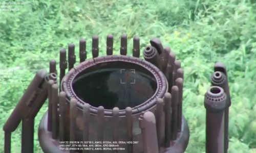
Capture accurate inspection data by surveying hard-to-reach areas around pipelines, flare stacks, cooling towers, and other equipment with automated flight paths and keep in / keep out geofencing capabilities of our drones to avoid hazardous zones.


Data Processing & Analysis

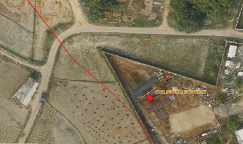
Process raw data on Asteria’s drone to data platform, SkyDeck and ensure fast turnaround times and accurate results.

  • Monitor cross-country pipeline routes remotely with aerial digital surveys, video, and image captures.
  • Access and compare historical data on a single platform to detect anomalies and changes.

Know more


Data Delivery

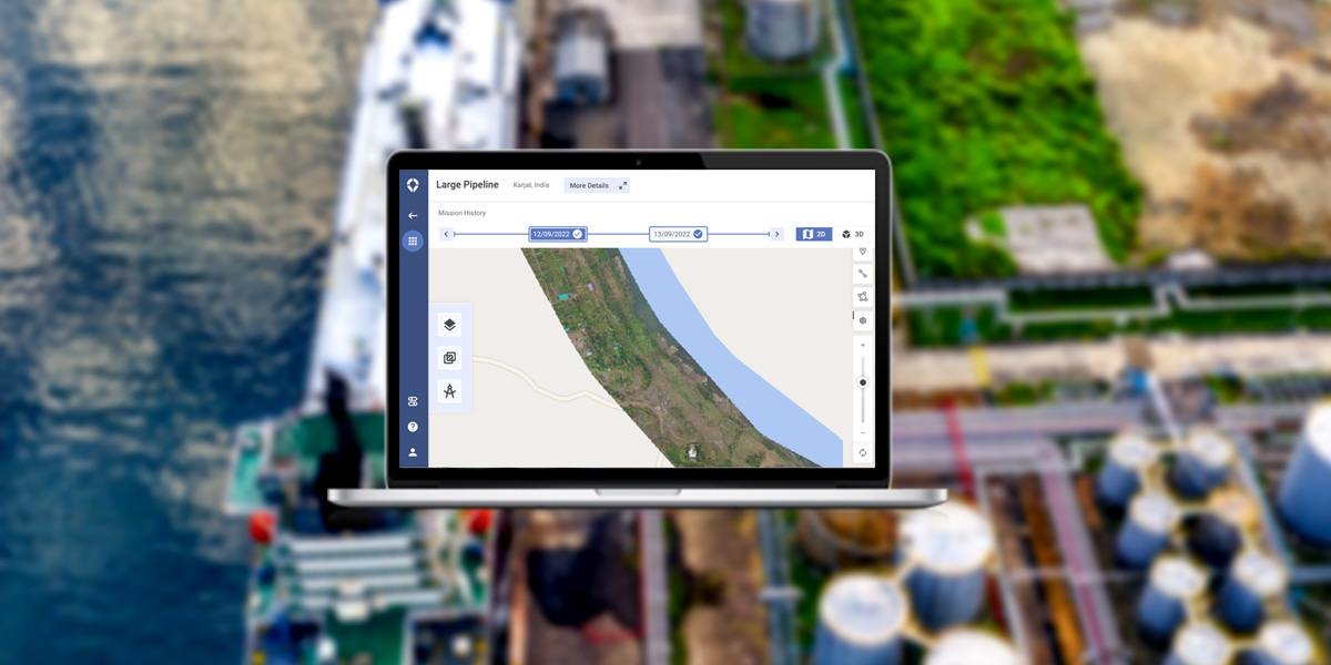
Securely interact with 2D/3D data, images, videos, and insights through a simple web browser using our end-to-end drone to data solution, SkyDeck. Get access to automated and customized reports through the same platform.

Benefits of Oil and Gas

icon-img

33%
increase in efficiency

icon-img

50%
reduction in inspection cost

icon-img

Enhance safety
of workers

icon-img

60%
increase in collaboration

Drone-as-a-Service (DaaS)


Don't have a drone? Leverage our End-to-End DaaS Solutions

Access full-service drone capabilities on demand, without the need for investing in hardware, software, or analytics.


Know more

Customers Speak

"Asteria performs pipeline surveillance for PIL using drones that ensure a thorough inspection of pipeline Right of Use (RoU) with the aid of high-resolution aerial images. Team Asteria consists of well-trained drone pilots and GIS & software engineers who store and analyze a myriad of high-resolution images to provide accurate information within our pipeline RoU. The drone surveillance reports generated have helped us to focus & enhance our RoU management program."

Sh. Suresh Iyer
Pipeline Infrastructure Limited

Connect with us

Require details for*

Frequently Asked Questions

Can’t find the answer here? Get in touch

What is drone inspection in the oil and gas industry?
+

Oil and gas drone inspection involves using drones to monitor pipelines, rigs, and infrastructure for damage, leaks, or corrosion. With advanced cameras and sensors, drones provide real-time data, enhancing safety and reducing operational downtime across oil and gas facilities.

What regulations govern drone inspections in the oil and gas sector?
+

Drone inspections for oil and gas operations must comply with local aviation authorities' guidelines, ensuring safe operations near sensitive areas. Regulatory frameworks address pilot certification, drone weight categories, and operational zones to ensure drones in the oil and gas industry operate within legal boundaries.

Are drones effective for emergency response in oil and gas?
+

Yes, drones are highly effective for emergency response in the oil and gas sector. They provide rapid aerial assessments of spills, leaks, or accidents, ensuring timely mitigation efforts.

What equipment is used in drone inspections?
+

Drones for oil and gas inspections are equipped with thermal cameras and high-resolution imaging sensors. These tools help detect anomalies in pipelines, flares, and rigs, ensuring comprehensive monitoring of critical assets.

How do drones improve safety in oil and gas operations?
+

Drones enhance safety by accessing hazardous areas, reducing the need for manual inspections. Whether it’s pipelines or offshore rigs, drones provide reliable insights while keeping personnel away from high-risk environments, making them indispensable for the oil and gas industry.